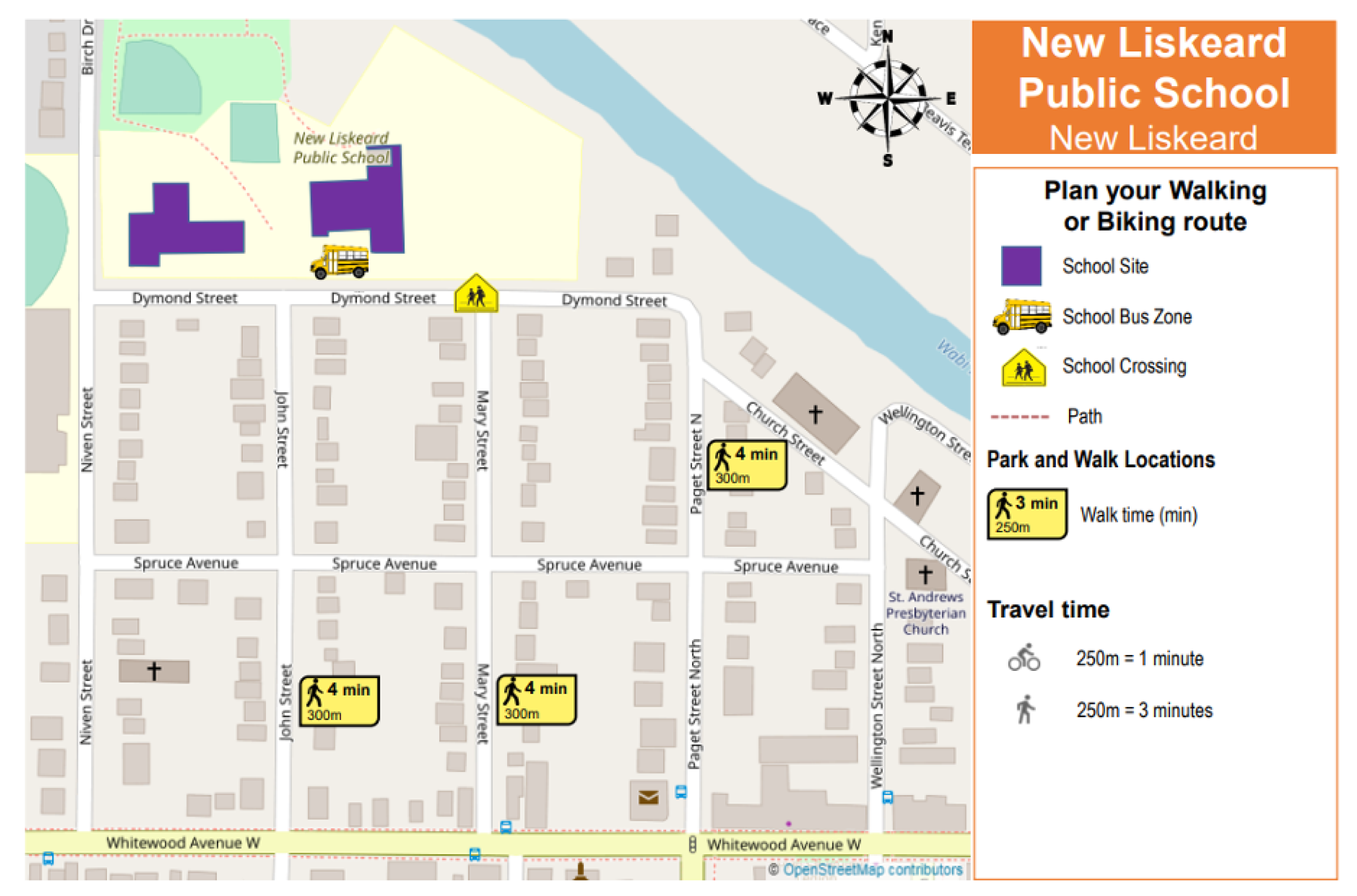
Park & Stride Maps
With knowledge, awareness, and lots of practice, children should be able to make the journey between school and home safely. Children will be able to find a safe route that will take them directly to school with the help of the caregiver accompanying them. It is important to identify potential dangers (railway tracks, busy intersections, etc.) in order to design a safe journey without forgetting to underline the safety rules.
Use these maps to:
- Help your child plan their active and safe route to school.
- Find a safe and legal parking spot a 1-2 blocks away from the school and walk the last leg of the journey.
- Be part of the solution. Avoid contributing to dangerous congestion in front of the school and allow all students a safer journey to school. Thank you!
Conseil scolaire catholique de district des Grandes-Rivières (CSCDGR)
École catholique Assomption (Earlton)
École catholique Assomption (Kirkland Lake)
École catholique St-Michel (Dymond)
École catholique Sainte-Croix (Haileybury)
École catholique St-Louis (Virginiatown)
Conseil scolaire public du Nord Est de l’Ontario (CSPNE)
École publique des navigateurs (New Liskeard)
District School Board Ontario North East (DSB1)
Central Public School (Kirkland Lake)
Federal Public School (Kirkland Lake)
Elk Lake Public School (Elk Lake)
Englehart Public School (Englehart)
Kerns Public School (Kerns Township)
New Liskeard Public School (New Liskeard)
Temagami Public School (Temagami)
Northeastern Catholic District School Board (NCDSB)
Sacred Heart School (Kirkland Lake)
Holy Family School (Englehart)
St. Jerome School (Kirkland Lake)
English Catholic Central School (New Liskeard)
St. Patrick Catholic School (Cobalt)